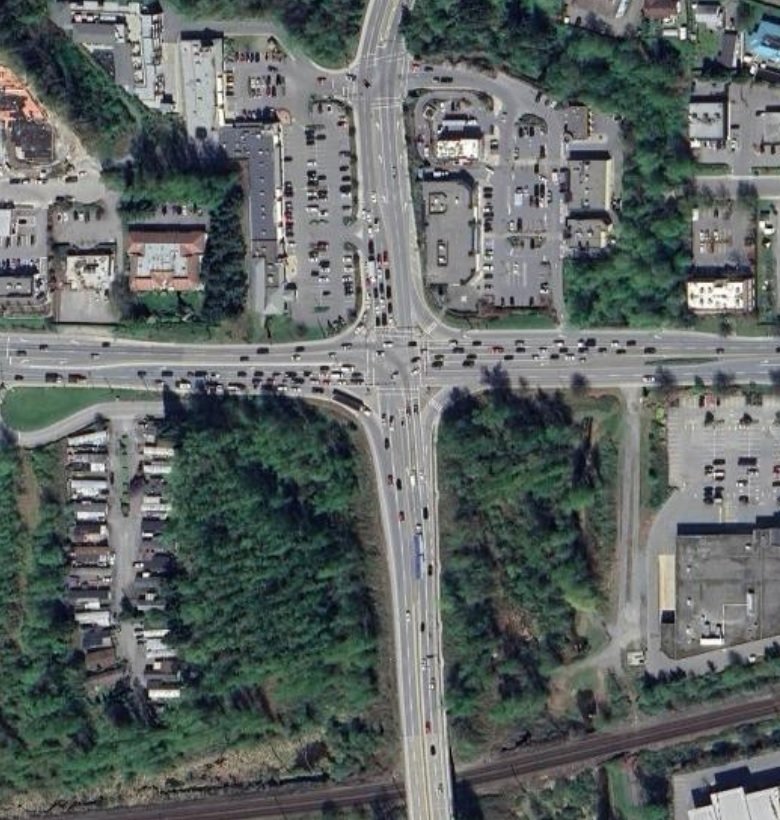
Highway 7 and 11 Intersection
Project Description
Mission, BC
Topographic Survey to be completed to the BC MoTI GSG Standards and delivered to Civil 3D BC MoTI TOR to
support the design of Road Intersection of Highway 11 and Highway 7 in the City of Mission.
Cross section will be maximum of 20m intervals and at any significant vertical/horizontal change.
Survey will include (6 Days with 2 man crew and 7 Days 1 man crew):
o Water valves, hydrants, meter boxes and other surface features.
o Sanitary and storm MH covers, and other surface features.
o Utility surface features such as Hydro, gas, telecommunications, cable boxes and poles, etc.
o Major structures including retaining walls and/or rock outcrops, if any.
o Trees, shrubs, fences, grassed area and/or other unique landscaping features, if any.
o Curb, gutter, medians, paved surfaces, road paint lines, signs and sidewalk including wheelchair ramps and/or driveways including driveway type (asphalt, conc, gravel, stamped concrete, etc.).
o UAV LiDAR Survey to capture extents indicated by Red Line in Image 1 below.
DTM surface and ortho-imagery deliverable only, no feature exaction included with LiDAR data.
o Compile all legal information as requested.
o Compiling Data from previous survey by WSP (shallow utilities and MH dips), if approved by MOTI
Confirmation of WSP data in field via checking MH dips where safe to do so (ie: outside the middle of the intersection.)
Additional survey of area indicated as attached and at all road intersections.
Extend survey to the North of Tim Horton’s building by 40m, to the South to Railway limits, 20m east of north/south access road on the east, and 20m past Hurd Street to the west.
Establish/confirm project control in UTM NAD 83 Zone 10 Datum using existing Geodetic Control Monuments.
Legal property ties to create a legal composite (Supervised by Professional Land Surveyor, 3D Land Surveying Inc.).